Multi-source live view
DJI drones, smartphones with the F2 app, body cameras, a field PC's screen: up to four sources per customer, side by side, on a single link.

See beyond the limit.
In serviceYour drones, your smartphones and your cameras in one live view, on a map that knows where each one is looking. For the person who decides, when every minute counts.
Argos does not replace your pilots or your teams. It gathers what they see and puts it on a map, live, so command sees the scene early and clearly enough to change a decision.
DJI drones, smartphones with the F2 app, body cameras, a field PC's screen: up to four sources per customer, side by side, on a single link.
Position, track and viewing cone of each drone on IGN map or aerial photo, in 2D or 3D with terrain. Distance, area and elevation-profile measurements.
During the flight, each photo lands on the map seconds after it is taken, visible and thermal. Two passes compare to show what changed.
Zoom, gimbal, photo, recording, aiming at a map point, from the command post. The pilot accepts on the remote controller and keeps flying.
Aircraft and airfields around the operation, third-party drones heard by Remote ID: you also see what is not yours.
Seven days of replayable, downloadable footage, backup to your NAS, and a log of people detected by AI with position and thumbnail.
The same screen stays readable from three metres on a video wall and at arm's length in full sun. No customer-side configuration: open the link, watch.
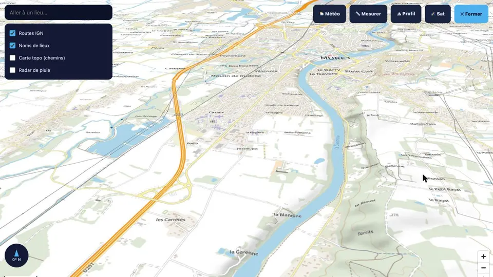
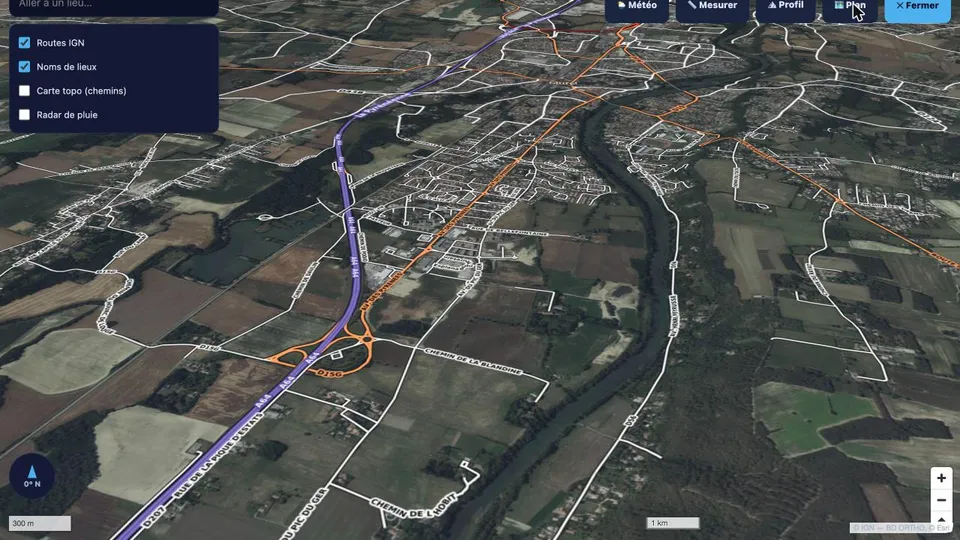
Firefighters, gendarmerie, police, civil protection, prefecture. A wildfire, a missing person, a flood: command sees what the drone sees, the moment it sees it.
Towns, metropolitan areas, engineering firms. You follow the mission you ordered without being on site, and get the orthophoto when it returns.
You offer your customers a live feed under their own name, with their logo, without depending on a consumer video service.
Each customer gets four sources and an isolated space. The subscription sets how many drones are visible at once and which modules are enabled.
1 drone
2 drones
4 drones
4 drones
Drone 31's pilots can fly your missions or train your teams. A software vendor has no pilots; a drone contractor has no platform. We have both.
No third-party video service, no ad network. The stream goes from the drone to your screen through our server, and nowhere else.
Each customer has its sources, links, logo and settings. A customer can neither see nor reach another's footage.
Streams and archives only open with the customer account's session; password and allowed-address list as options.
Geolocated logins, logged camera commands, PDF reports. You know who watched what, and when.
Any DJI drone able to stream RTMP (Mavic, Air, Mini, Avata, Matrice), Android smartphones running the F2 app, body cameras and a PC's screen share. A customer's sources show side by side in one view.
A few seconds in standard streaming, the time of 4G transport and video assembly. Position and camera heading arrive live on the map.
Only people holding the customer's link, protected by the account session, and optionally by password and allowed-address list. Each customer is isolated from the others on a server in Europe.
Argos controls the drone's camera (zoom, gimbal, photo, recording, aiming at a map point) after the pilot's explicit consent on the remote controller. Flying the aircraft stays with the pilot.
No. Argos opens in a browser, on a video wall, a tablet or a phone. The pilot keeps the usual DJI app; a configuration link is enough.
A thirty-minute demo, with a drone flying over Muret or at your site. You leave with a trial link and a proposal sized to your fleet.